Mount Somers
Tags : Mountain
Time Required : 3 - 5 hours
Ways to Experience this attraction
Mount Somers, Christchurch Overview
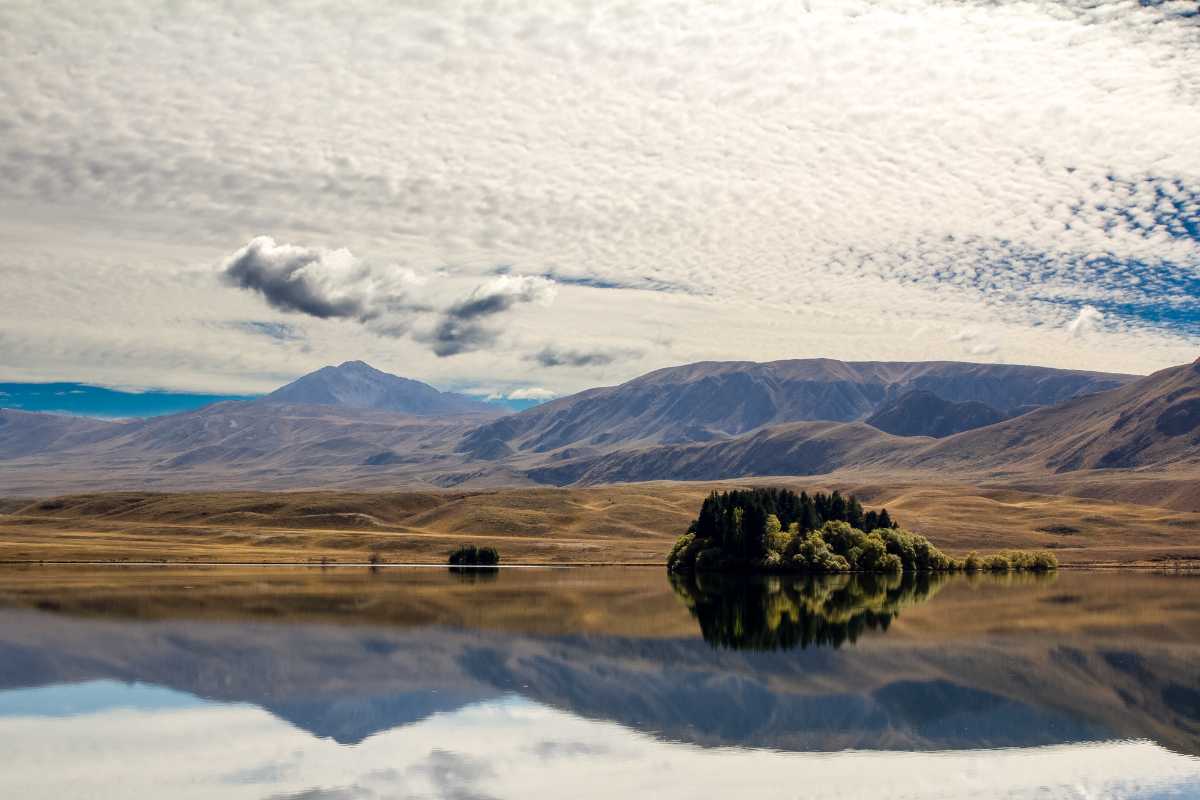
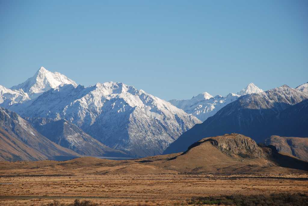
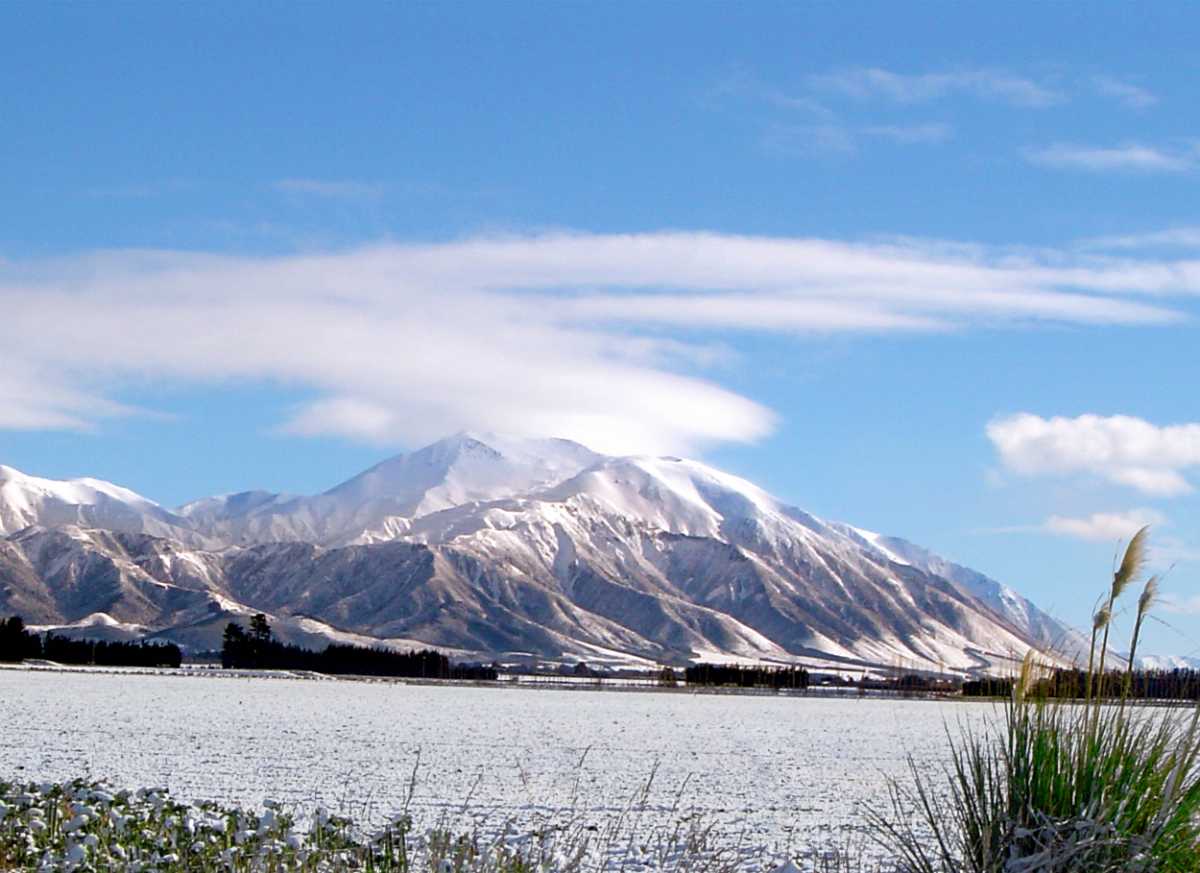
Tucked away at the Southern Alps' foothills, halfway between Christchurch and the Mackenzie Basin on the Inland Scenic Route 72, Mount Somers is an idyllic countryside town in Canterbury, New Zealand. Boasting utter tranquility, open sub-alpine tussock lands, historic coal mines, impressive volcanic formations, deep canyons and gorges, the town is home to just 3000 people.
However, owing to the natural beauty and the gorgeous setting, several holiday homes have sprung up in the destination as Mount Somers is lately gaining a lot of popularity among vacationers, nature lovers and solitude seekers. Unlike the other countryside towns of the country, the economy of this one does not rely on agriculture alone but also resorts to coal, clay, sand and limestone mining in the hills behind the town.
Considered to be a haven for adventure seekers and adventure sports enthusiasts, the town offers several recreational activities and sports, including tramping & hiking, fishing for trout and salmon, horse treks, mountain biking, windsurfing on the lakes and bird watching etc.
Read More on Mount Somers
Places to Visit
Lake Clearwater
Among the most popular activities are-
- Salmon and Trout Fishing
- Boat Rowing
- Windsurfing and Sailing
- Kayaking
- Jet Skiing and Water Skiing
Mt. Somers Conservation Area
Mt. Somers is a common ground which is the meeting point or the linking point several several picnic spots and trekking trails in the area. The most significant picnic spots in the region include Woolshed Creek and Sharplin Falls. There are also several trekking trails that have their base point at the Mt. Somers Conservation Area. These trails will take you through a dreamland of historic coal mines, impressive volcanic formations, a deep river canyon and gorges etc. You can also undertake the several birdwatching tours and nature walks to explore the area.Among the myriad activities available in the area are also hot air ballooning, which is also the most popular touristy activity and helicopter rides to have a 360 degree aerial view of the place. Besides you can also try your hand at Mountain Biking, Horse Riding, Mountain and Rock Climbing, Horse Trekking, and Rock Hounding for Agate Stone etc.
“Edoras” or Mt. Sunday
Mt. Hutt
Mount Somers Track
The area in and around Mount Somers makes way for several trekking trails and hiking expedition routes that are popular among the tourists as well as the locals. Among the myriad trekking and hiking options available, the highlight of the region is the Mount Somers track which was conceived and started by Mt. Somers and Staveley locals in 1983. The track was finally opened for the public in 1987 and the management was handed over to the Department of Conservation. The track is basically a 1 - 2 day run around the path circuiting the area connecting the popular Pinnacles and Woolshed Creek huts.Given below is a break down of the route and timings of the hike.
- Sharplin Falls Track Junction
The trek is undertaken on foot and takes you through beech forest/ tawhai rauriki in the backdrop of the mountains. This covers the distance between Bowyers Stream to Sharplin Falls Track Junction.
Sharplin Falls Track Junction to Pinnacles Hut
Time - 3 hours (5.2 kms)
This is the slightly longer leg of the hike which will require you to climb atop steep mountains and through another section of mountain beech forest/ tawhai rauriki to Dukes Knob and Bowers Stream to the Hut.
Pinnacles Hut is a resting spot with 19 bunk beds, heating and mattresses etc.
- Pinnacles Hut to Woolshed Creek
Pinnacles Hut is the area formed after the cooling off of lava from the volcanic eruptions some 90 million years ago. After you reach the hut, follow the markers and the trails through tussock and subalpine scrub up to the Mt Somers saddle which is at an altitude of 1170 m. Since the tramping is easy, it wouldn’t take much time. Once you reach the pinnacle or the saddle, among the enchanting panoramic vistas, the more gorgeous views include that of Taylor and Old Man Ranges. The breathtaking scenery is meant to be captured in both the cameras and the memories.
Woolshed Creek Hut is a resting spot with 26 bunk beds, heating and mattresses etc.
On the descent, you will come across a diversion that can lead you to the “caves”. These interesting boulders are a short trip from the diversion and can be explored if you have time. Most tourists choose to take a little detour. After you are done, you can follow your trail and along Morgan Stream and Woolshed Creek to Woolshed Creek Hut.
- Woolshed Creek Hut to Woolshed Creek car park via Miners Track
From Woolshed Creek again, the track rises to a high point and you will be mind blown with the gorgeous views of the upper Ashburton Gorge before coming down to old Blackburn Mine. After following a track of an olden day coal mine, the route leads to Woolshed Creek car park.
- Woolshed Creek Hut to Rhyolite Ridge Track junction via Mt Somers Track
This trekking route follows through a verdant green scenery between regenerating mountain beech forest/ tawhai rauriki, crystal icy pools, rocky tors and gurgling waterfalls. From the Woolshed Creek Hut, the route accents 500 metres to lead to a local rest stop called Bus Stop Overhang. After crossing the face of Mount Somers, this track then leads to Rhyolite Ridge Track.
- Rhyolite Ridge Track junction to Mt Somers Summit Track junction
After crossing the Southern face of Mount Somers, the track leads through open grasslands and catchments, before it rises to an altitude of 1080 m above the sea level. Offering some of the very best views in the entire trek, the Mount Somers Summit Track is the junction where you can also find Acland Shelter. This distance of 4 kms can be covered in 1.5 hours and you can rest here for sometime.
- Mt Somers Summit Track Junction to Sharplin Falls car park
This is the final descent downwards and follows regenerating forested areas. The climb downwards is easy and hardly exhaustive.
History
Flora and Fauna at Mount Somers
Among the wildlife, exotic and rare birds can be found habitating here along with the regular breeding birds of the region. The most notable bird which nests at Mount Somers is falcon/kārearea. Another rare bird that can be spotted sometimes is Mount Somers bluff wētā Deinacrida.
Geology
How To Reach Mount Somers
- Located in the inland mid- Canterbury region, at the foothills of the Southern Alps, the closest village and/or towns near the area are Staveley village, and Mt Somers township.
- You can reach Staveley village through the inland from Ashburton.
- Alternatively, it is a 1.5 hours drive from Christchurch. Take the inland Scenic Highway 72, and turn off at the Staveley signpost and follow the road towards Sharplin Falls car park.
- Woolshed Creek can also be reached through inland Scenic Highway 72. Take the road till Mount Somers township, drive for another 10 kms on Ashburton Gorge Road before you reach Jig Road from where you need to take a right. Drive for another 3.5 kms to reach Woolshed Creek picnic area.
