Route: Gangotri – Nala Camp – Rudragaira BC – Gangotri BC – Auden’s Col BC – Auden’s Col – Khatling Glacier – Waterfall Camp/Zero Point – Chowki – Masar Tal – Mayali Pass – Vasuki Tal – Kedarnath – Gaurikund
Total distance covered: 115 km
Passes crossed: Auden’s Col (5490m/18010 ft), Mayali Pass (5000m/16400 ft)
No. of trekking days: Planned – 12 days, Actual – 11 days.
Dates we trekked on: 1st Jun 2015 - 11th Jun 2015
This trek starts from a temple and ends at another, ticking off 2 temples of the Chardham. I didn’t know until I was there that I was on a religious trip!! (which I would have avoided in all cases, if not for a trek).
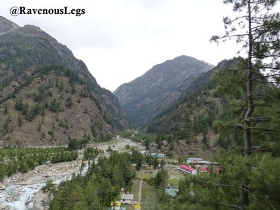
The roadtrip to the base started from Rishikesh. After crossing beautiful valleys of Uttarkashi, Bhaironghati and Harsil, we arrived to our base Gangotri.
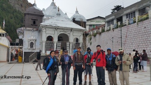
Team7 at Gangotri temple


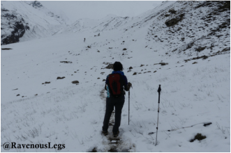
After steep ascend from Nala Camp we crossed the stream and ascended to another mountain. It was “All heads down and all breathes high” day. A very tough, steep and strenuous climb ended at Rudragaira BC. We encountered snowfall again during the last patch of climb. The tents kept getting frosted and we had to clear the roof every few minutes to avoid them getting frozen.
Steep ascend to Rudragaira BC
Towards Rudragaira BC
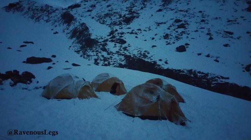
Frosted tents


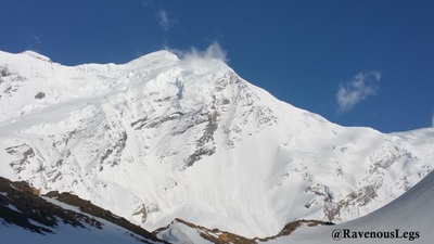
This day’s ascend involved negotiating moraine and technical surfaces. The sky was clear for sometime and we got view of Rudragaira peak on our way. Heavy wind had kicked off while walking on the ridge. The trek became very difficult as the snow started hitting hard on the face. The ascend was steep again. After crossing the frozen lake we got beautiful views of Gangotri peaks from our campsite.


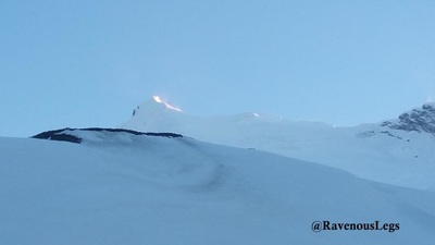
The ascend was easy as our bodies had acclimatized well by now. There was a fresh avalanche observed near the Auden’s Col base camp, so we decided to camp a little lower at 4650m. That meant we had to start for Auden’s Col pass earlier than planned. The view of Auden’s Col from the campsite brought smiles on all faces. Extreme cold night and anxiety for next day contributed to sleepless night!


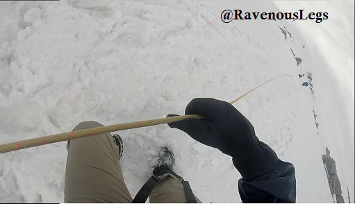
Day6: Auden’s Col BC (4650m/15250 ft) to Auden’s Col Pass (5490m/18010 ft) to Khatling Glacier (5000m/16400 ft) – 16 km / 11 hrsThe day started with breakfast at 03:00. The wind flow and snow storm was getting wilder and so was the tension in the dining tent! Everything including shoes, shoe laces, hands, feet were frozen and with much difficulty we got dressed in our gears. Suddenly I exclaimed “I’m scared”. Each one then confessed their fear too, but nobody had the thought of going back. After giving fist pounds to eachother, without wasting anytime, we started off our ascend with bold hearts. The idea was to cross the pass (6 km ascend) and reach the campsite at Khatling glacier before the sun is up and snow starts melting. The moon light trek gave pretty view of Auden’s Col, the first rays of sun emerged out of the dusk – Damn!!! how I wish I could go back in time and feel all these all over again.


Day7: Khatling Glacier (5000m/16400 ft) To Chowki (3540m/11100 ft) - 16 km / 8hrs
I got up in the morning to realize that the climb to Auden’s Col had damaged my shoes. The pasting of the sole had started coming off due to toe-kicking ascends and heel-kicking descends in the snow. I prayed that they survive for few more days. We continued walking on Khatling glacier, escaping the crevasses. After the glacial stretch, there was continuous descend through moraine and heavy boulders by the river. We clubbed 2 days as per itinerary and headed to Chowki from zero point on the same day.


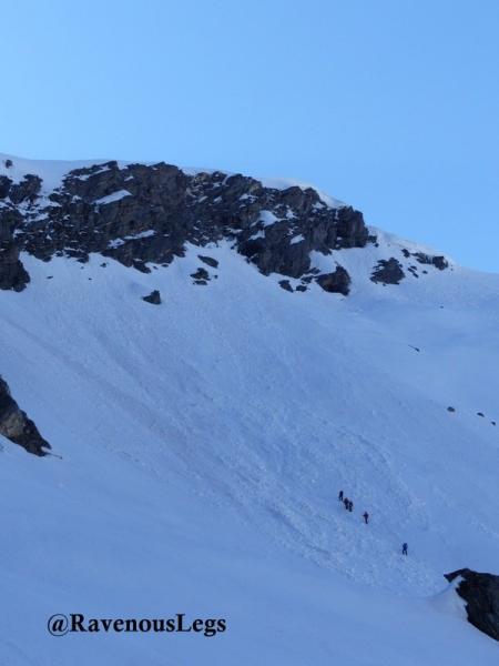
Just when we felt relaxed about snow and tough ascends, our hopes were killed by yet another day of steep climb. The ascend was on meadows, moraine and snow again. Some patches of ascend were dangerously steep. The beautiful views of Thalay Sagar peak and the ridge overlooking the valley were breath taking. We camped near the frozen lake Masar Tal. I felt like waking up at this campsite for the rest of my life.


Day9: Masar Tal (3675m/12050 ft) to Mayali Pass (5000m/16400 ft) to Vasuki Tal (4135m/13560 ft) – 12 km / 8 hrs
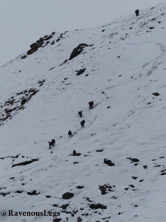
Yet another tough and long day. We thought the worst was over and we were surprised with the difficulty level of each day. We crossed the frozen and crystal clear Masar Tal and ascended the steep ridge to Mayali pass. After a strenuous walk cutting the snow mountains, there was again a steep climb to the Mayali pass. The descend from Mayali pass was technical. We had to rappel down the steep snow mountains. The day ended on a fun-note as we enjoyed sliding down the mountains to the next campsite near Vasuki Tal.
Ascend to Mayali Pass
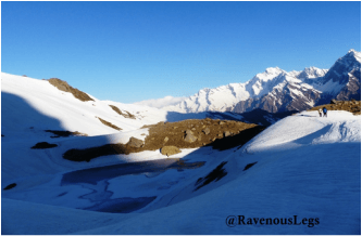
Masar Tal
Day10: Vasuki Tal (4135m/13560 ft) to Kedarnath (3580m/11750 ft) – 8 km / 8 hrs
This day was expected to be lighter on our legs, but the gratuitous amount of snow left us heavy on breathes and legs. The trail started with beautiful view of Vasuki Tal and a natural pool around it. The ascend to the ridge was steep and descend on the snow was risky. The sight of Kedarnath which was heavily ruined due floods and cloud burst 2 years back, was tragic.


Day11: Kedarnath (3580m/11750 ft) to Gaurikund (1830m/6000 ft) – 21 km / 5 hrs

Kedarnath Temple
This entry has been shortlisted for Holidify’s Travelogue Writing Contest in association with Linger. The content and pictures may not be used without prior permission of the author.
Submitted by: Medhavi Davda
The original post can be found here.


About Holidify.com
Holidify.com is the Highest Rated Travel App in India used to find holiday ideas. Download the app here and you will be surprised to know that there are so many amazing destinations in India that you must visit.